'Yass' will intensify into a very severe cyclonic storm on May 26: IMD
By ANI | Published: May 23, 2021 05:59 PM2021-05-23T17:59:00+5:302021-05-23T18:05:08+5:30
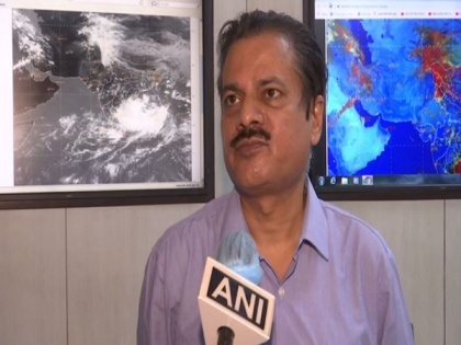
The low-pressure area which formed over the east-central Bay of Bengal on Saturday morning, has intensified into a depression on Sunday and by Monday morning, it will form a cyclone namely Yaas, informed the India Meteorological Department (IMD) Director General of Meteorology Dr Mrutyunjay Mohapatra.

'Yass' will intensify into a very severe cyclonic storm on May 26: IMD
The low-pressure area which formed over the east-central Bay of Bengal on Saturday morning, has intensified into a depression on Sunday and by Monday morning, it will form a cyclone namely Yaas, informed the India Meteorological Department (IMD) Director General of Meteorology Dr Mrutyunjay Mohapatra.
"It is very likely to intensify into a very severe cyclonic storm. It will cross West Bengal and north Odisha coasts on the evening of May 26," informed Dr Mohapatra.
IMD had predicted the wind speed of the cyclone to be around 155-165 km per hour, gusting to 185 km per hour.
Speaking to ANI, Dr Mohapatra said, "This is a very large-scale and damaging wind speed. It is almost similar to the wind speed of cyclone Tauktae. Even cyclone Amphan, which made landfall last year, also had a similar wind speed."
"Low-pressure area on the east-central Bay of Bengal has concentrated into a depression today & it is located about 700 km away from Balasore and Digha. It is expected to move north and northwestwards and intensify into a cyclonic storm by May 24 morning," he added.
Heavy rainfall is expected to start on May 25 evening. On May 26, heavy rainfall is expected at a few places and extremely heavy rainfall is expected at isolated places over north Odisha districts and West Bengal, informed the IMD Director-General.
"In addition to rainfall, there will be tidal waves inundating the low-lying areas, as those coastal areas are very shallow. There are be three-four metres of tidal waves when the cyclone crosses the coasts," added Dr Mohapatra.
We have constantly been issuing warning states to suspend all coastal activities including fishing. No one should enter the sea during this time, alerted Dr Mohapatra.
Meanwhile, on Sunday Prime Minister Narendra Modi chaired a high-level meeting to review the preparedness of the States and Central Ministries/Agencies who will be dealing with the disaster arising out of the predicted cyclone 'Yaas.'
( With inputs from ANI )
Disclaimer: This post has been auto-published from an agency feed without any modifications to the text and has not been reviewed by an editor
Open in app