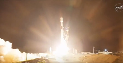
SpaceX launches NASA’s Sentinel-6B satellite to monitor sea level change
By IANS | Updated: November 17, 2025 11:50 IST2025-11-17T11:45:18+5:302025-11-17T11:50:19+5:30
New Delhi, Nov 17 SpaceX on Monday launched NASA’s Sentinel-6B satellite aimed at monitoring sea level change, the ...

SpaceX launches NASA’s Sentinel-6B satellite to monitor sea level change
New Delhi, Nov 17 SpaceX on Monday launched NASA’s Sentinel-6B satellite aimed at monitoring sea level change, the US space agency said.
Sentinel-6B is an Earth-observing satellite jointly developed by NASA and US and European partners to observe the ocean and measure sea level rise.
The satellite will build on over 30 years of sea level data to improve weather forecasts. It will help improve coastal planning, protect critical infrastructure, and advance weather forecasts.
“Liftoff! The latest in a long line of satellites to monitor sea level change, Sentinel-6B, successfully launched at 12:21 am ET (10:55 AM IST) on Monday, from Vandenberg Space Force Base,” NASA said in a post on social media platform X.
“This is the second Sentinel-6 satellite Falcon 9 launched after delivering the Sentinel-6 Michael Freilich satellite to orbit in November 2020. Together, the two spacecraft will measure sea levels, improve forecasts of ocean currents as well as wind and wave conditions, and enhance both short- and long-term weather predictions,” added SpaceX.
Sentinel-6B will deliver data on about 90 per cent of Earth’s ocean, providing direct benefits to humanity.
The data is key to helping improve public safety, city planning, and protecting commercial and defense interests.
Data from the satellite will also help NASA prepare for the next phase of space exploration, including safer reentry of astronauts returning from Artemis missions.
Data collected by the mission can help city planners, as well as local and state governments, to make informed decisions on protecting coastal infrastructure, real estate, and energy facilities.
The satellite’s sea level data also improves meteorologists’ weather predictions, which are critical to commercial and recreational navigation, forecasts of hurricane development, including the likelihood of storm intensification, which can aid disaster preparedness and response.
Data from Sentinel-6B will better protect coastal military installations from such events as nuisance flooding while aiding national defense efforts by providing crucial information about weather and ocean conditions.
Disclaimer: This post has been auto-published from an agency feed without any modifications to the text and has not been reviewed by an editor
Open in app