Mumbai's BEST Bus Routes to Integrate with Google Maps for Seamless Commuter Experience
By Lokmat English Desk | Updated: March 23, 2025 09:45 IST2025-03-23T09:44:57+5:302025-03-23T09:45:23+5:30
The Brihanmumbai Electric Supply and Transport (BEST) undertaking is set to revolutionize the city's public transport system by integrating ...

Mumbai's BEST Bus Routes to Integrate with Google Maps for Seamless Commuter Experience
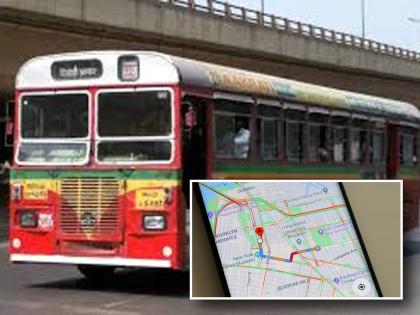
The Brihanmumbai Electric Supply and Transport (BEST) undertaking is set to revolutionize the city's public transport system by integrating its vast bus network with Google Maps. In a move aimed at improving journey planning and overall efficiency, commuters will soon be able to access real-time information for all 402 bus routes operated by BEST, which runs a fleet of approximately 2,900 buses.
Currently, there is no system in place to track BEST bus routes with live suggestions for commuters. This new integration will address that gap, offering optimal route options and making daily travel more convenient for passengers. Additionally, BEST is working on improving operational efficiency, with plans to reduce the wait times between buses from the current 35-45 minutes to just 15-20 minutes.
In February 2024, the Maharashtra government signed a Memorandum of Understanding (MoU) with Google to bring artificial intelligence (AI) into public services. As part of this collaboration, BEST has joined forces with Google to integrate its bus routes into Google Maps. BEST general manager SVR Srinivas confirmed, “We have had multiple meetings with Google, and we expect the service to be available to the public within a month.” Once launched, commuters will simply enter their starting point and destination into Google Maps, which will then suggest the best possible routes, taking into account live GPS data.
The system will not only recommend the most efficient bus routes but also offer multi-modal transport options, combining BEST buses, metro services, local trains, auto-rickshaws, and taxis for seamless last-mile connectivity. For example, a passenger traveling from Mira Road to Ghatkopar will receive real-time updates and route suggestions that might include a mix of BEST buses, metro, or local trains, depending on which option is fastest.
The new system is also expected to help BEST optimize its operations by identifying underutilized routes and replacing them with new, higher-frequency routes where demand is greatest. For example, data could highlight areas with a heavy presence of auto-rickshaw passengers, prompting BEST to introduce smaller, more frequent buses to better serve those corridors. This integration with Google Maps is set to mark a significant step toward modernizing Mumbai’s public transport network, providing commuters with real-time insights and enhancing overall travel efficiency.
Open in app