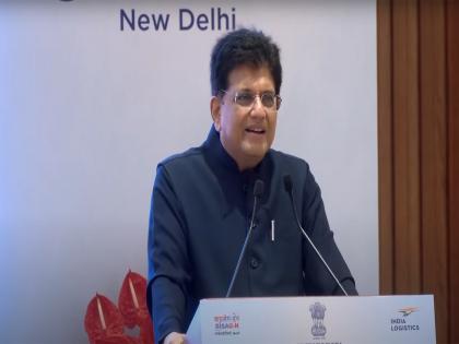
Piyush Goyal launches PM GatiShakti Public platform to democratize access to geospatial and infrastructure data
By ANI | Updated: October 13, 2025 18:40 IST2025-10-13T18:35:35+5:302025-10-13T18:40:03+5:30
New Delhi [India], October 13 : The Logistics Division, Department for Promotion of Industry and Internal Trade (DPIIT), Ministry ...

Piyush Goyal launches PM GatiShakti Public platform to democratize access to geospatial and infrastructure data
New Delhi [India], October 13 : The Logistics Division, Department for Promotion of Industry and Internal Trade (DPIIT), Ministry of Commerce and Industry, commemorated the completion of four transformative years of the PM GatiShakti National Master Plan (NMP) with a special event in New Delhi on Monday, chaired by Union Minister of Commerce and Industry Piyush Goyal.
Among the key initiatives inaugurated at the event, the launch of "PM GatiShakti Public" through the Unified Geospatial Interface (UGI) marks a significant milestone in democratising access to infrastructure and geospatial data.
"This query-based web platform provides regulated access to selected non-sensitive datasets from the PM GatiShakti NMP, enabling private entities, consultants, researchers, and citizens to leverage advanced analytics for infrastructure planning and investment decisions," the Ministry of Commerce & Industry said in a release.
Developed by the Bhaskaracharya National Institute for Space Applications and Geo-informatics (BISAG-N) and powered by the National Geospatial Data Registry (NGDR), the platform allows users to access 230 approved datasets covering physical and social infrastructure assets, conduct site suitability analyses, connectivity mapping, alignment planning, and compliance checks, and generate analytical reports based on pre-defined templates and user-defined criteria.
The release noted that users can also visualize multi-layered geospatial data, promoting better project design, inter-agency coordination, and private sector participation.
Access to the platform is enabled through self-registration with strong authentication and data security protocols to ensure confidentiality and compliance with policy norms. The platform will continue to evolve in subsequent phases with the addition of new data layers and analytical modules based on user feedback and emerging needs.
Launched on 13 October 2021, PM GatiShakti has revolutionised infrastructure planning and implementation in India by integrating geospatial data from more than 57 Central Ministries, Departments, and States/UTs. The initiative has brought a paradigm shift in coordinated infrastructure development, leading to faster project execution, reduced logistics costs, and improved service delivery, thereby catalysing economic growth and enhancing India's global competitiveness.
"Over the past four years, PM GatiShakti has evaluated hundreds of major infrastructure projects, onboarded all Central Ministries, Departments, and State Governments, and adopted cutting-edge technologies such as Artificial Intelligence for planning and analysis. The initiative continues to evolve as a cornerstone of India's infrastructure development framework," the release added.
Disclaimer: This post has been auto-published from an agency feed without any modifications to the text and has not been reviewed by an editor
Open in app